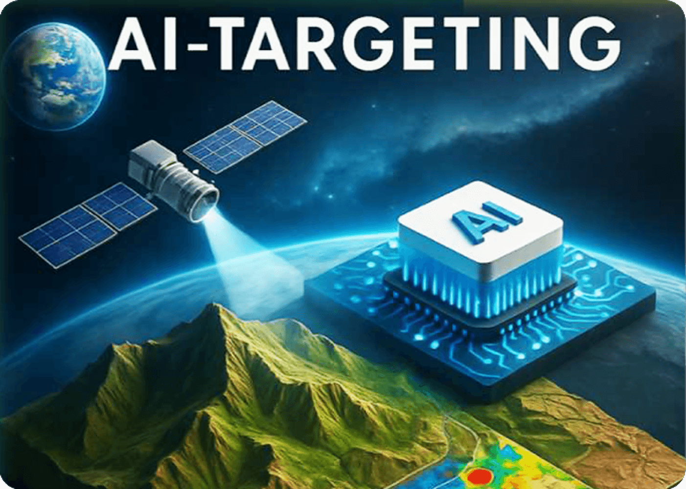
EXPLORATION AI PLATFORM CONCEPT
The Exploration AI Platform is an integrated, AI-driven geospatial system designed to identify and forecast zones of deep mineralization (up to 400 meters).
The platform is built on the integration of multiple data sources and advanced modeling methods, including:
• Sentinel-2 satellite imagery in the VNIR and SWIR ranges (multispectral and hyperspectral data)
• Geochemical data, including current survey results and historical exploration data
• Machine-learning methods and neural networks
(Random Forest, XGBoost, Stacking Classifiers, Bayesian Inversion, Convolutional Neural Networks, DBSCAN/HDBSCAN, K-Means, Gradient Boosting)
• A validated spectral database of mineral and gas “fingerprints”
________________________________________
CORE FUNCTIONS
The system performs automatic pattern recognition, depth extrapolation, and anomaly clustering while accounting for the full geological context — including stratigraphy, lithology, tectonics, and hydrothermal fluid pathways.
APPLIED ALGORITHMS (RANDOM FOREST, CNN, BAYESIAN INVERSION, ETC.)
Kumba Exploration and Mining Limited (Zambia) and Rhino Exploration Ltd (Europe/Africa) have formed a strategic alliance that combines advanced artificial intelligence technologies with many years of mineral exploration experience in Africa.
________________________________________
OUR CORE COMPETENCIES
• Application of Sentinel-2 satellite spectral data (VNIR/SWIR) for the identification of mineral indicators, hydrothermal alteration zones, and forecasting of structural–ore controls.
• Integration of geological, geochemical, and geophysical data sources into a unified spatial modeling framework.
• Use of artificial intelligence and machine-learning algorithms
(Random Forest, XGBoost, Stacking Classifiers, Bayesian Inversion, Convolutional Neural Networks, DBSCAN/HDBSCAN, K-Means, Gradient Boosting) for:
o forecasting deep mineralization (down to 500 m and deeper);
o automatic detection and classification of spectral, geochemical, and geophysical anomalies;
o clustering of mineral systems and delineation of structural domains;
o generation of Prospectivity Maps and Domain Maps as a basis for targeting and mineral potential assessment;
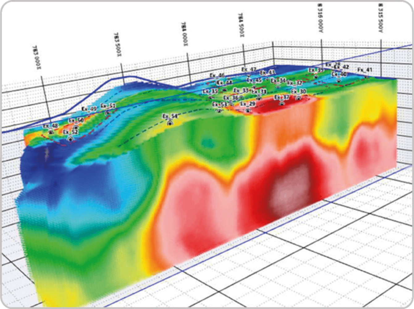
o development of 2D and 3D geological predictive models used to identify and prioritize drilling targets.
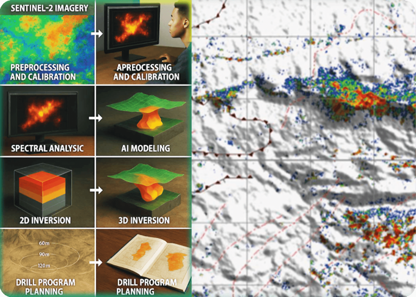
EXPLORATION MAPS & VISUALIZATIONS
Integrated Exploration Targeting Model
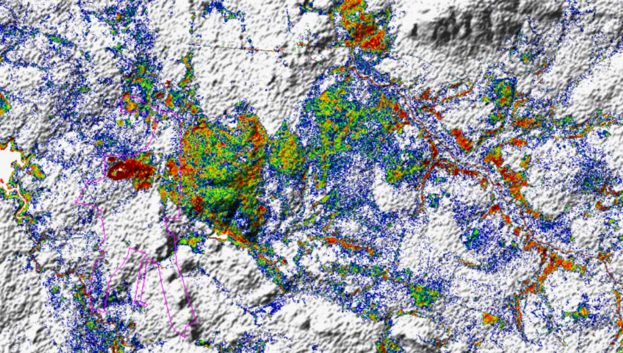
Spectral Anomaly Map
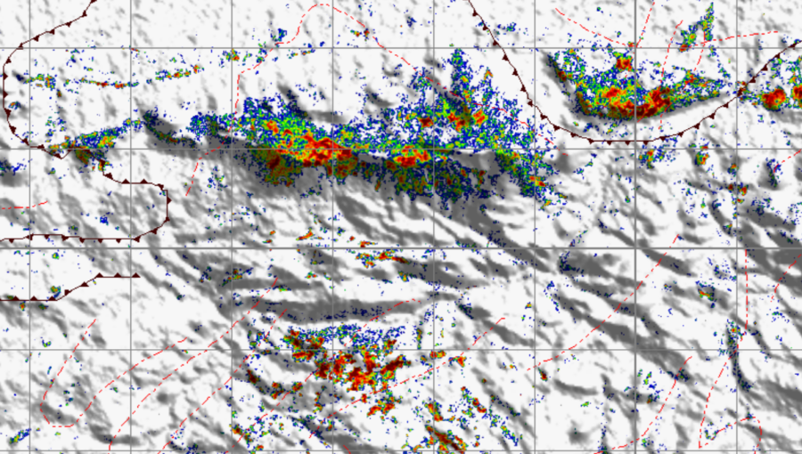
Structural Trend and Anomaly Map
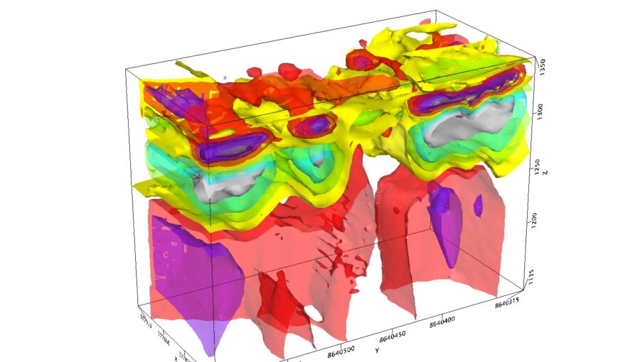
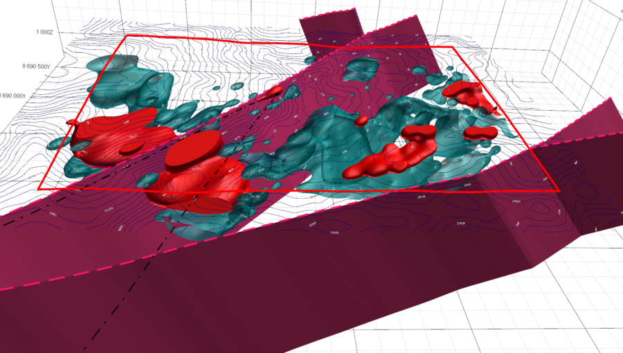
3D Anomaly Zone Model
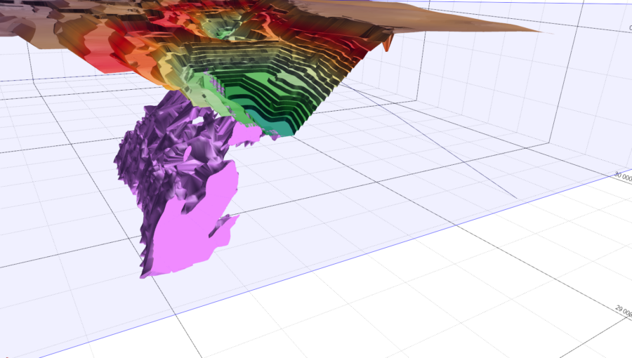
Volumetric Mineralization Model
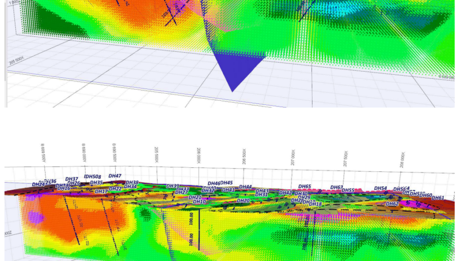
Preliminary Drilling Program
PARTNERSHIP WITH RHINO EXPLORATION, MIRA GEOSCIENCE, ETC.
The development of the platform was carried out by a consortium of specialists in the fields of geology, geophysics, and artificial intelligence:
• Rhino Exploration Ltd — leading developer of geological modules and machine-learning modules;
• Mira Geoscience (Canada) — consultants in three-dimensional inversion and probabilistic modeling;
• Micromine experts — construction of wireframe and block models of deposits;
• Specialists in spectral geophysics (South Africa) — calibration and verification of spectral signatures.
________________________________________
STRATEGIC PARTNERSHIP
Kumba Exploration and Mining Limited (Zambia) is a strategic partner in the field of advanced geophysical studies and AI-oriented mineral resource targeting in Africa.
The cooperation is aimed at building deep target models using ground-penetrating radar (GPR), spectral, and geochemical data.
Integration of artificial intelligence and machine-learning algorithms with the results of geophysical surveys and field observations;
Implementation of joint projects for copper, gold, rare earth elements, and lithium in Zambia and other African countries.
This partnership significantly strengthens the technological base and expands the operational capabilities of the Exploration AI platform.
Contacts
KUMBA Exploration and Mining Ltd
Тел.: +260 0975174411
Email: info@kumbaexploration.com
Время работы:
Mon–Fri: 09:00 – 20:00
Burma Road, Woodlands,
Lusaka, Zambia, Plot 14
Dmitry Slutskiy
Director
WhatsApp: +260 779291845
Michael Goldwyn
Principal Geologist
WhatsApp:+260 776052190
Mikhail Pilosyan
Operations Director
WhatsApp: +260975174411